How It Works
Three steps, no desktop software
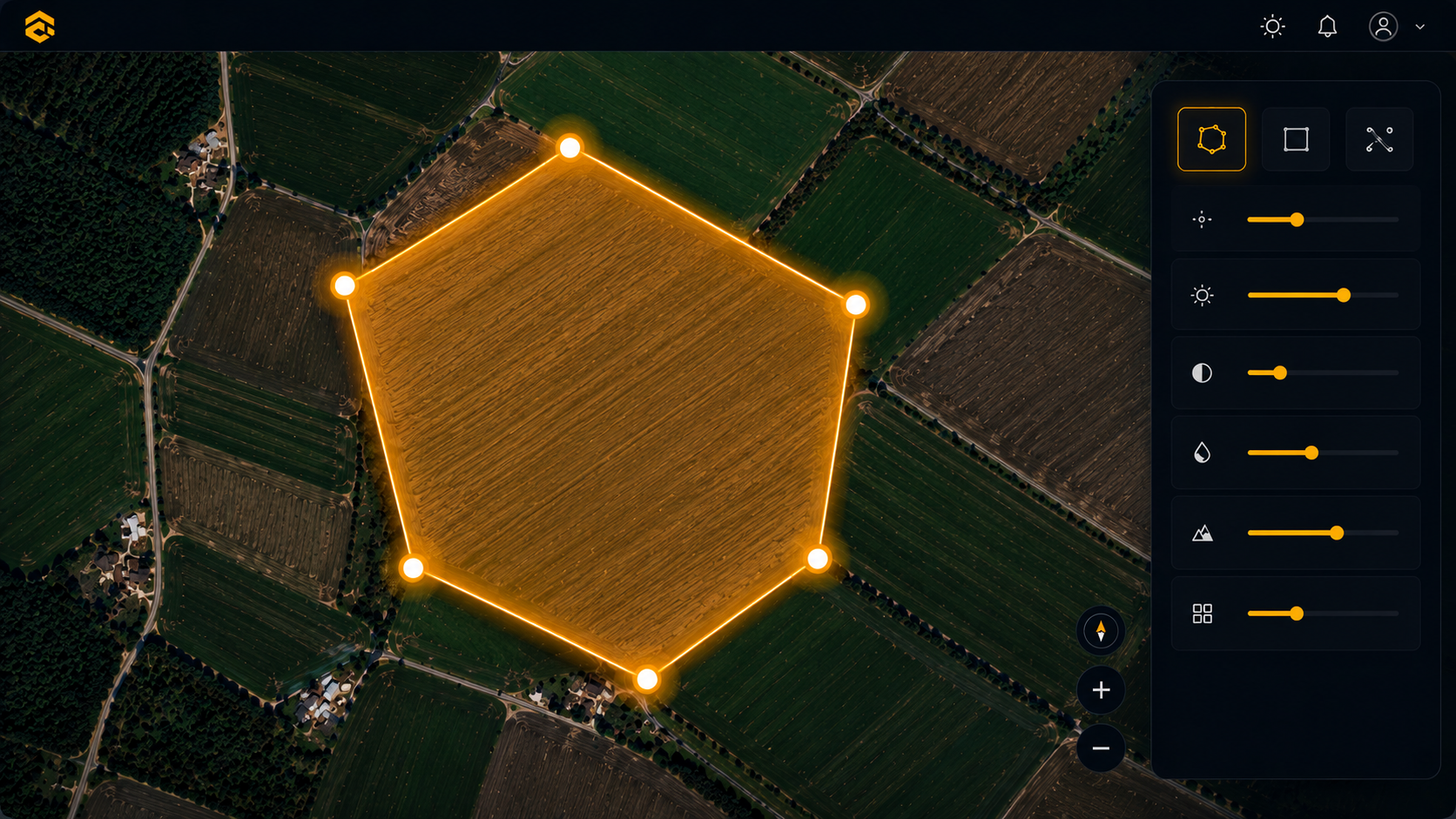
01
Draw
Open the web map, draw your survey boundary, and see area and flight stats update instantly.
→
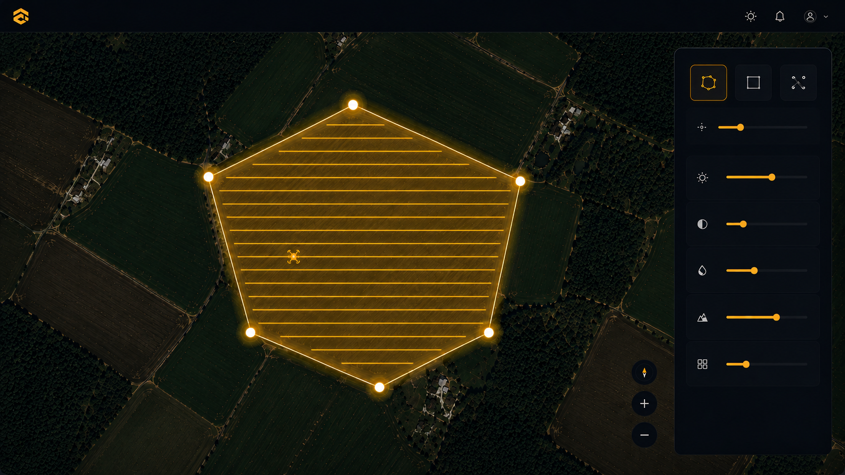
02
Configure
Set altitude, speed, overlap, and flight direction. Live GSD and battery estimates update as you tune.
→
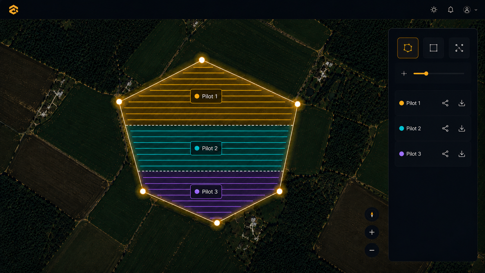
03
Distribute
Split the area, generate a KMZ per pilot. Each pilot opens a link and downloads their mission directly.